The Philippines, located on the Pacific Ring of Fire, is no stranger to seismic activity. This archipelago nation is regularly hit by earthquakes due to its position at the convergence of multiple tectonic plates. Over the centuries, the Philippines has experienced numerous significant earthquakes that have shaped its history and influenced its approach to disaster preparedness and response. This extended timeline highlights some of the most impactful seismic events in the nation’s history, showcasing the resilience and adaptive measures undertaken by the Filipino people.
Centuries of Earthquake Activity

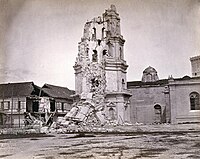
Luzon Earthquake of 1645
In 1645, one of the earliest recorded significant earthquakes in the Philippines struck Luzon. This devastating quake, estimated at a magnitude of 7.5, severely affected Manila, causing extensive damage to buildings and infrastructure. Historical records describe the collapse of houses, churches, and public buildings, illustrating the earthquake’s impact on the colonial capital.

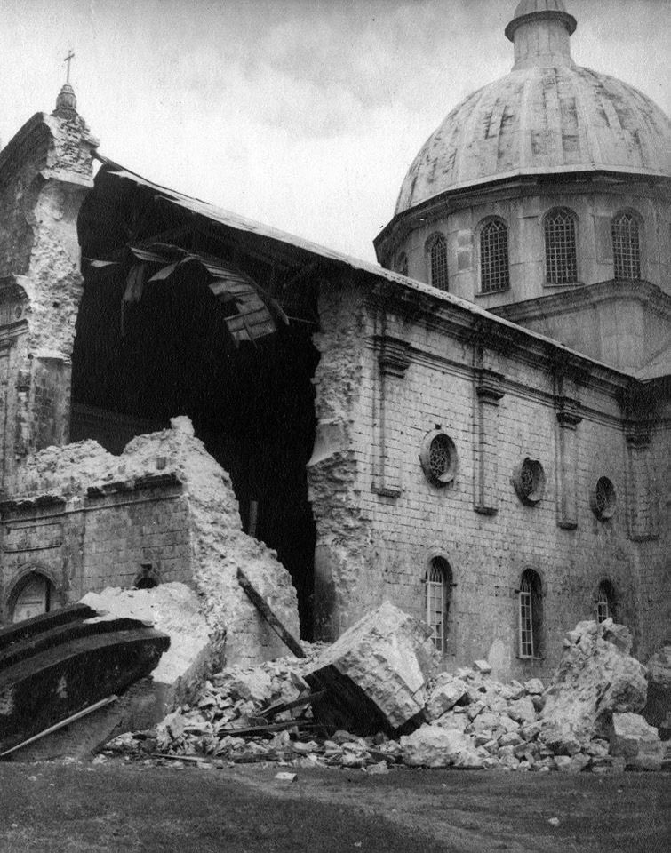
Philippine Earthquake of 1863
In 1863, Manila experienced another catastrophic earthquake. This disaster caused severe damage throughout the city, destroying numerous buildings and leading to significant loss of life. The level of devastation was such that it significantly altered local construction practices and the urban landscape.
1880 Earthquakes on Luzon
A series of powerful earthquakes struck Luzon in 1880, further emphasizing the island’s vulnerability to seismic activity. The most significant of these quakes had magnitudes estimated between 6.5 and 7.0. The repeated shocks caused widespread panic and damage, particularly in Manila and nearby provinces.
Panay Earthquake of 1948
In 1948, an 8.1 magnitude earthquake struck the island of Panay. This quake caused widespread destruction across the island, including in the city of Iloilo. The earthquake, one of the strongest recorded in the Philippines, highlighted the need for improved building standards and disaster preparedness.

Moro Gulf Earthquake of 1976
A devastating 7.6 magnitude earthquake struck the Moro Gulf in 1976, triggering a massive tsunami that resulted in over 5,000 deaths. This disaster had a profound impact on Mindanao and the Sulu Archipelago, with many coastal communities being wiped out. The event underscored the deadly combination of seismic activity and tsunamis in the region.
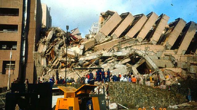
1990 Earthquake on Luzon
In 1990, a powerful 7.7 magnitude earthquake rocked Luzon, causing extensive destruction, particularly in Baguio City. The quake resulted in around 2,400 fatalities and left a significant mark on the region’s infrastructure. Buildings, bridges, and roads were heavily damaged, highlighting the need for stringent building codes and disaster preparedness.
2012 Earthquake in the Visayas
In 2012, the Central Visayas region was struck by a 6.7 magnitude earthquake, causing widespread damage and loss of life. The quake impacted several provinces, leading to structural damage and highlighting the vulnerabilities in infrastructure and disaster response mechanisms.
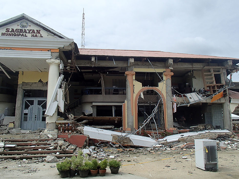
Bohol Earthquake of 2013
In 2013, the Central Visayas experienced another major earthquake, this time measuring 7.2 in magnitude. The quake significantly affected Bohol and Cebu, resulting in over 200 deaths and causing severe damage to heritage sites, including centuries-old churches. The destruction emphasized the need for preserving and reinforcing historical structures.

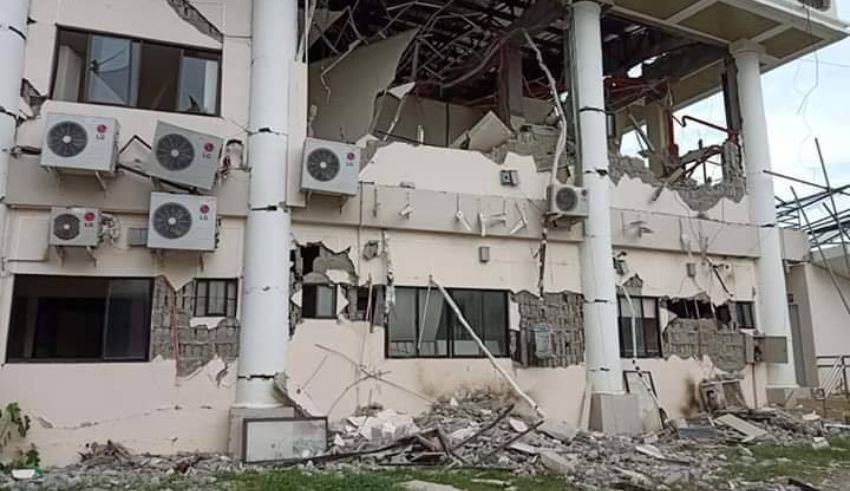
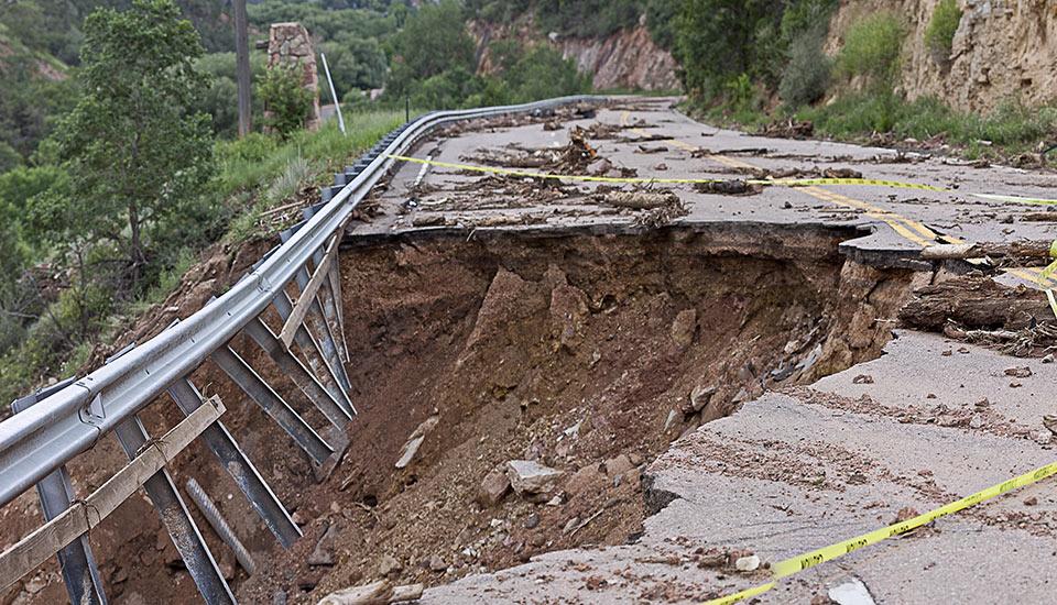
2019 Earthquakes in Mindanao
In 2019, Mindanao was hit by a series of high-magnitude earthquakes, causing fatalities, injuries, and displacing thousands of residents. The quakes, with magnitudes ranging from 6.3 to 6.9, resulted in significant structural damage and tested the region’s disaster response and resilience.
Geological Setting
The Tectonic Scene
The Philippines’ frequent seismic activity is primarily due to its location at the convergence of several tectonic plates, including the Philippine Sea Plate and the Eurasian Plate. This tectonic setting creates a complex and active seismic environment, resulting in numerous earthquakes and volcanic activities. The subduction zones and fault lines crisscrossing the archipelago make it one of the most earthquake-prone countries in the world.
Readiness for Action
Improving Safety Measures
To mitigate the impact of earthquakes, the Philippines has implemented various safety measures and preparedness initiatives:
– National Earthquake Drills: Regular earthquake drills are conducted to ensure that the population is prepared and knows how to respond during an earthquake. These drills are vital for raising awareness and ensuring readiness at all levels of society.
– Philippine Institute of Volcanology and Seismology (PHIVOLCS): PHIVOLCS actively monitors seismic activity and provides valuable research, early warnings, and advisories. The institute plays a crucial role in disaster risk reduction and management by conducting studies, issuing forecasts, and promoting public awareness.
– Building Codes and Construction Practices: The government has enforced stricter building codes to ensure that structures are resilient to seismic activity. These regulations aim to minimize damage and casualties during earthquakes by promoting earthquake-resistant construction techniques.
– Community-Based Preparedness Programs: Various programs are in place to educate and train communities in earthquake preparedness, first aid, and emergency response. These programs empower local communities to respond effectively in the event of a disaster.
Conclusion
The Philippines has a long and significant history of earthquakes, with each event contributing to the country’s evolving approach to disaster risk reduction and management. From historical quakes that shaped early urban landscapes to modern seismic events that have driven advancements in building codes and emergency preparedness, the nation’s resilience continues to grow. By building on past experiences and continuously improving its preparedness and response strategies, the Philippines strives to safeguard its people and infrastructure against future seismic threats. The commitment to enhancing safety measures and fostering a culture of preparedness ensures that the nation is better equipped to face the challenges posed by its geologically active setting.